A Closer Look
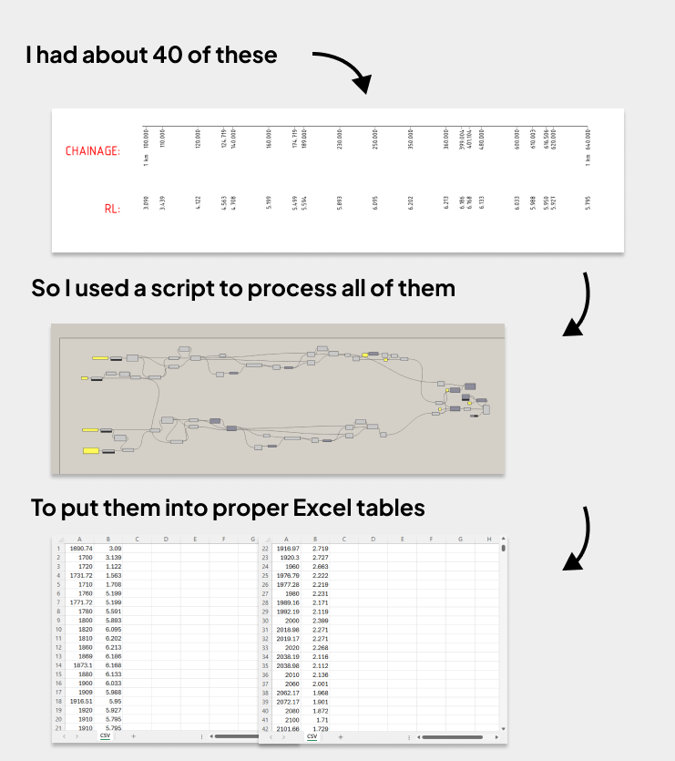
Boreholes are one of those things that are just annoying to deal with.
As part of the structural consultant team, we didn’t design them but we still had to include them in our models so everything could be viewed in context. And the data could come in just about any format.
Sometimes it was a PDF. Sometimes a DWG. And if we were really lucky, we’d get an Excel sheet with all the data in the right format.
To make the process easier and more consistent, I wrote a script that reads from a standardized Excel sheet and places boreholes into Revit. It handles the transformation from real-world coordinates into the Revit space and fills in all the relevant metadata automatically. There’s even another script that takes these borehole data and creates a topological surface.
The main caveat is that the script relies on standardized input. So someone still needs to prepare that. That might mean manually entering data from a PDF, DWG, or an Excel sheet.
But with a standardized format in place, I’ve been able to go back to clients and request borehole data in that format from the start. And most of the time, they’re happy to do it, especially when they know it’ll save everyone time.