A Closer Look
This was one of my favorite tools to build, mainly because it solved a really frustrating problem for the traffic team. It was also just fun to work directly with them and learn more about what traffic engineers actually do.
As part of their road planning and access analysis, the team needed to understand how new roads or entrances would affect residents nearby. They had a list of residential addresses, target places like shopping malls, schools, or parks, and a road layout of the surrounding area.
To see the affect of new/removing roads, they had to calculate walking distances of the residents to the target locations. To do that, they would manually plug each address into Google Maps and jot down the travel times to every target location. With 100+ residents and 10–15 destinations to check, that analysis could take days. And worse, they had to redo it every time a road or entrance changed.
So I built a tool to help automate the entire process.
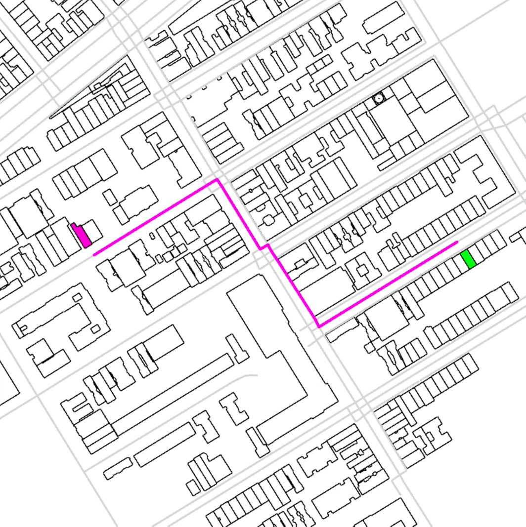
They already had everything the tool needed. It worked off their list of addresses, their list of destination addresses, and their set of road curves (a road network). The tool would then calculate the shortest walking path between each pair and show the results visually.
The tool finding the shortest walking path
This ended up being one of the most impactful tools I’ve worked on, because it made something genuinely painful so much easier. It saved the team time, helped them move faster, and fit right into the way they already worked.